Map Project
Methodology Behind The Map
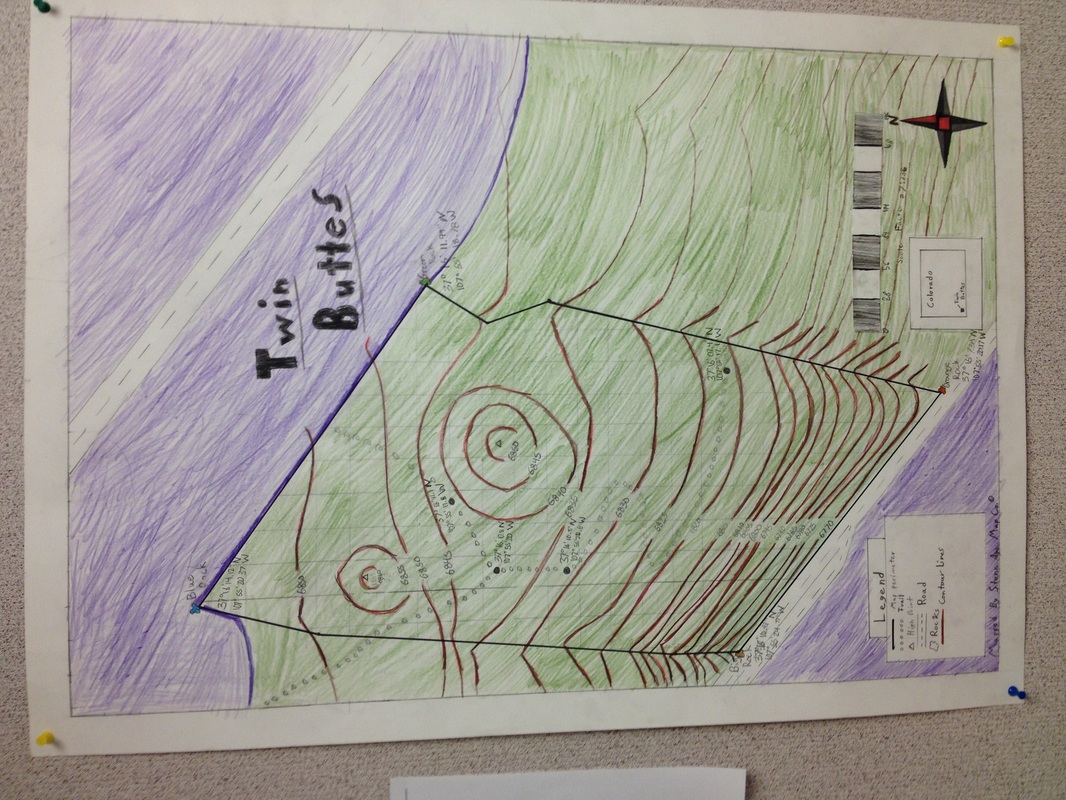
By Cameron Flann, Dylan Katz, Kyle Colley, Luke Stetler, and Zack Wood
This all started with a compass and a blank sheet of paper. We began by starting at the orange rock in the lower right corner, with an angle pointing towards green rock. We then proceeded to write the bearing down on a sheet of paper. We repeated this process multiple times until we had all sides of the roughly rectangular area in which we were instructed to chart. Between bearing measurements, we counted our steps in as equal a manner as possible to get a rough distance. We rescaled our paces to two millimeters per pace and used a protractor to convert our bearings into angles on the paper. Google Earth allowed us to view where the contour lines should land. Contour lines are basically a way to portray elevation on a map. The closer they are together, the steeper the terrain. This is why a topographic map is useful, it allows you to get an idea of elevation from a map view. We used spatial awareness to find the high points and map the trail. We were required to be very conscious of all of our surroundings. This project has been the most outdoors related project this year, and was very enjoyable for all of us
